The West Yorkshire town of Knottingley is located fifteen miles south west of Leeds, just east of the A1 and M62 motorway interchange. Greyhound Racing is known to have taken place in the town during the 1940’s, beginning during the latter end of 1940, with gatherings still known to have taken place during 1949.
Results failed to feature in the local press during 1943 and 1944 and it is presumed that racing ceased during this period due to hostilities. The venue operated as a flapping track, and results shown in the local press shows that distances were staged over 230 and 410 yards.
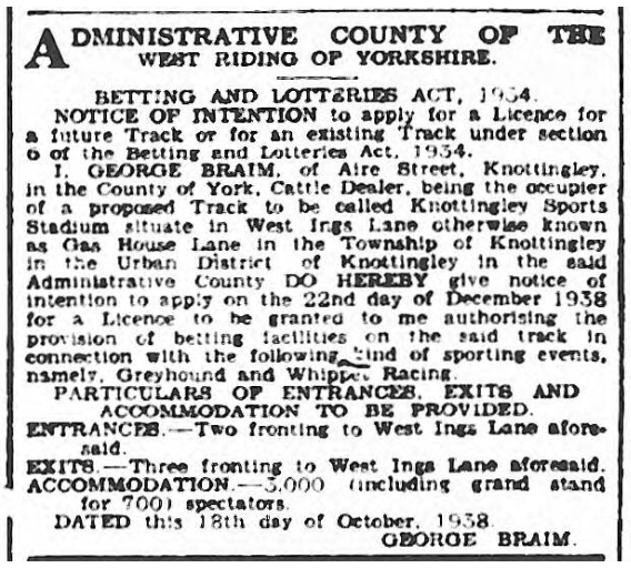
The venue’s location has caused some confusion when researched, but this is my presumption. An advert dated 1940 shows that the venue was located on Gas Works Lane. But when searching through Ordnance Survey maps from that period, Gas Works Lane does not exist. Yet an old Gas Works site is shown on West Ings Lane, which is situated roughly half a mile north of Knottingley town centre. Further information from the OS maps shows a building in a field to the east of Gander Haven Farm just south of the River Aire. It is my presumption that this venue was located here. I must stress that with limited information available my presumption needs confirming, but if it is, the site of the Knottingley Sports Stadium is now covered by trees and a river defence bank, and it is presumed no evidence of the venue remains.


Recent Comments